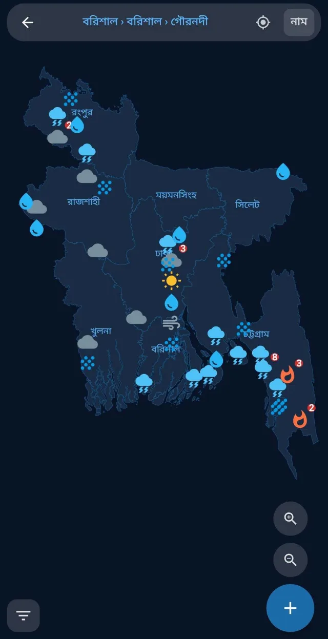
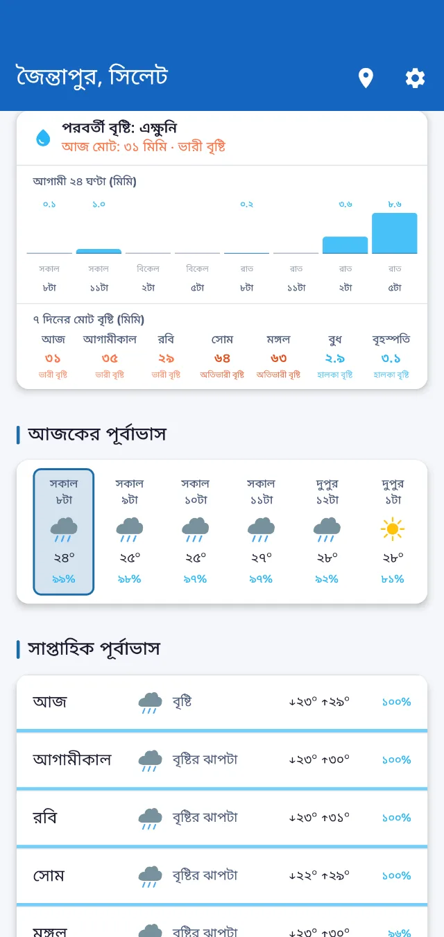
Upazila-level forecasts, meteorologist-written warnings, and crop advisories for Bangladesh. In Bangla, free, and working when the network doesn't.
10K+ downloads on Google Play · Bangla-first · Free · No signup
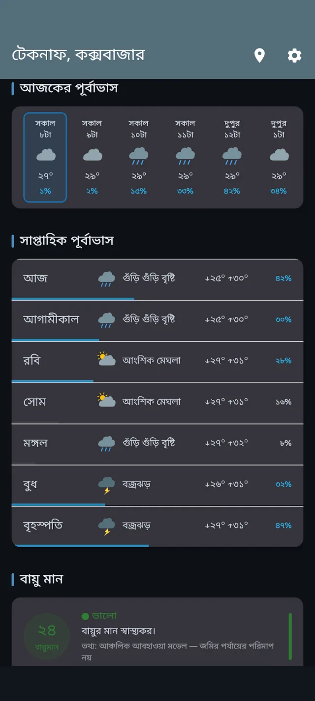
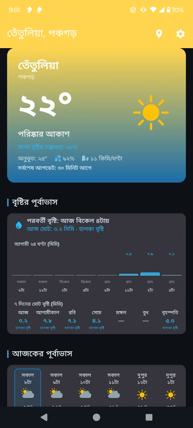
Abohawabid on Android, as it ships today.
Featured In
Bangladesh, home to 170 million people on the front line of climate change, faces monsoon floods, cyclones, thunderstorms, lightning, and flash floods every year. Yet the forecasts people depend on are too generic, too imprecise, and never say what to actually do.
Our Kalboishakhi storms, haor floods, and six distinct seasons make Bangladesh's weather unique. We're building an app that understands our weather and the needs of our people: in Bangla, for Bangladesh.
Generic national forecasts miss the microclimate variations that determine planting, irrigation, and harvest timing at field level.
Flood, cyclone, and storm alerts reach rural communities hours too late, in complex technical language few can act on quickly.
Existing solutions are English-heavy and globally generic, built for the world at large rather than for Bangladesh.
yvortex combines precision meteorology and agricultural science to deliver actionable intelligence across three critical domains.
Forecasts for all 64 districts and 552 upazilas/thanas, refreshed every 30 minutes from models run by NOAA, ECMWF, and regional meteorological agencies.
Rule-based crop advisories, reviewed by agronomists, triggered by rainfall, heat, and wind in your own upazila and tailored to Bangladesh's growing seasons.
Simple Bangla push alerts for floods, cyclones, Kalboishakhi storms, and lightning, with upazila-level precision, not just district-level.
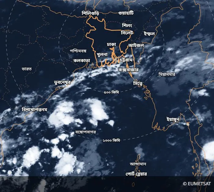
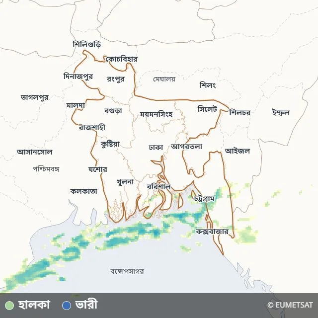
US AQI with Bangla descriptions, plus an hourly rain forecast showing intensity and when the next shower arrives. Heat-wave and cold-wave detection flagged inline in the weekly outlook.
Crowdsourced ground truth: users submit photos, videos, and text reports of local conditions that appear as live pins on the map.
Works without constant internet. Cached weather data, home screen widgets, and low-data mode designed for rural Bangladesh connectivity.
Global weather data, a rule-based advisory engine, and meteorologist-authored bulletins, all delivered to your phone, online or off.
We pull current conditions, hourly forecasts, 7-day outlooks, and air quality from weather models run by renowned national services: NOAA GFS, ECMWF IFS, and regional meteorological agencies. Cached on your device so the app opens instantly, even on 2G.
Automated advisory rules run against each day's forecast and surface only those relevant to your occupation and crops. In parallel, named meteorologists publish cyclone, flood, and heat-wave bulletins through an internal admin panel.
Push notifications reach your phone tagged by division, district, and crop. Weather and advisories are cached locally so the essentials keep working when your network does not.
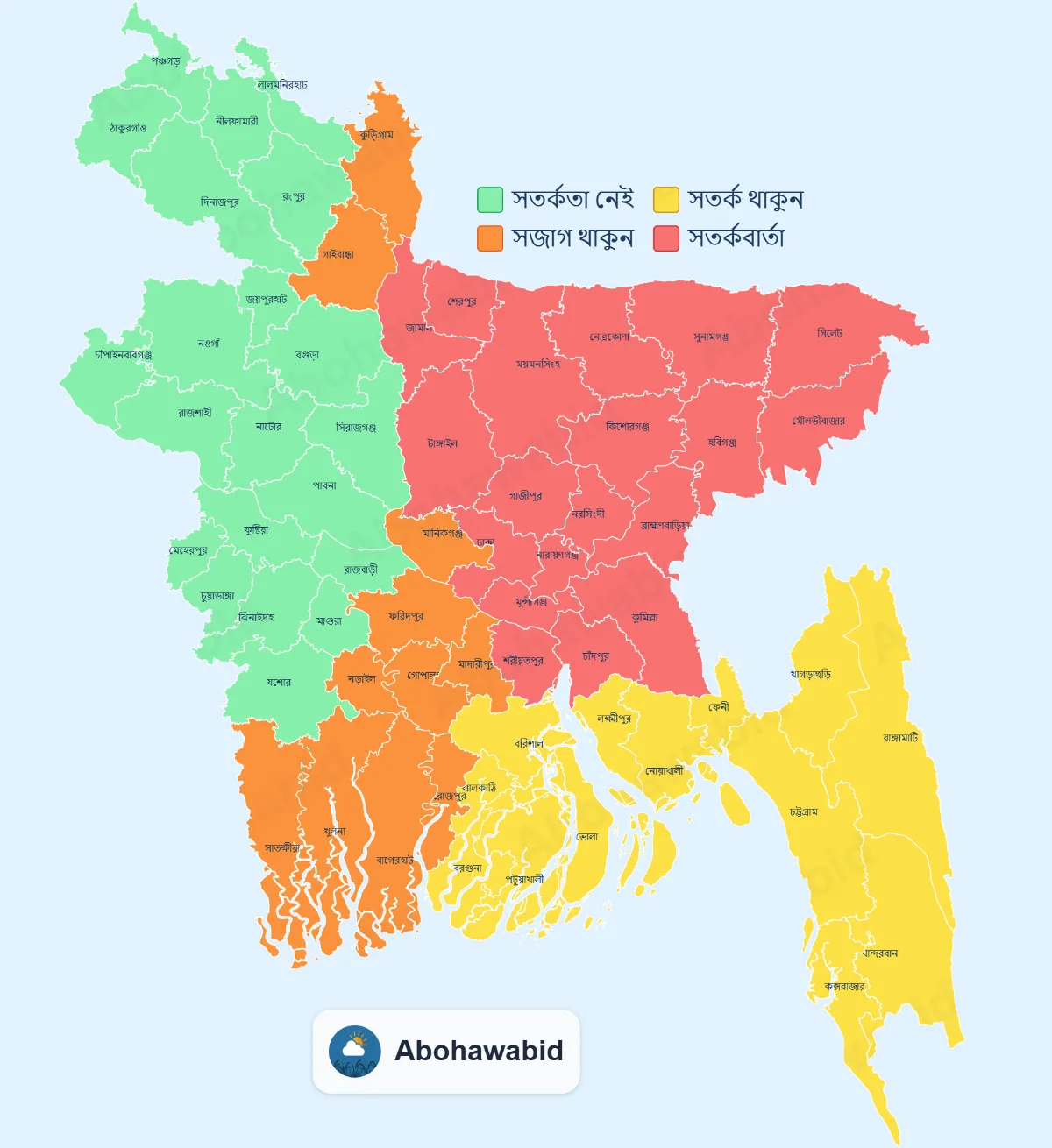
When a meteorologist publishes a bulletin, every district is coloured by severity, from no alert to warning, and the map travels with the push notification and the share card. This one went out with the Friday forecast on 2 October 2026.
From a farmer timing the next irrigation to a fisherman reading the morning sky, millions of decisions in Bangladesh ride on the weather. Abohawabid is built for the people making them.
Smallholders and cash-crop growers timing planting, irrigation, and harvest.
Coastal and river fishers reading wind, waves, and storms before they leave shore.
Day workers planning around rain, heat, and sudden storms.
Street sellers and SMEs whose daily takings ride on the sky.
Road and inland-water operators routing around floods and storms.
Tourists and commuters checking conditions before they move.
Shrimp and fish pond farmers exposed to cyclones, tidal floods, and salinity surges.
Coastal salt producers whose harvest depends on long, dry, rain-free spells.
Open-air fish dryers who can lose a whole batch to one unforecast shower.
From the field
Photos and reports sent in by Abohawabid users through the Citizen Science feature: rain and storms, lightning strikes, landslides, coastal surges. Other users see them on the map and can flag anything that looks wrong; the photos are reviewed and published here daily.
Read how it works in Prothom Alo (26 July 2026).
Loading recent photos…
Questions from users
Ask a question in the app and someone on the weather desk writes back. Questions like these come in every day.
Three real exchanges from October 2026. Names, contact details, and village-level locations removed; otherwise shown as written.
Abohawabid (আবহাওয়াবিদ) is our Bangla-first Android app, built for everyone, from Dhaka urbanites to Sylhet farmers.
Beyond forecasts and advisories, yvortex is building a set of farmer-facing tools that fit how rural Bangladesh actually works: low bandwidth, limited literacy, and high stakes.
Photograph a diseased leaf, get an instant Bangla diagnosis and treatment advice. Runs on-device where coverage is spotty.
Hyperlocal sowing, irrigation, and harvest alerts, triggered by your district's forecast and your specific crops.
Bay of Bengal sea-state, wind, and wave forecasts shaped for fishermen: safe windows to sail and return.
Book a short call with a certified agronomist. Pay via bKash. Bring a specific problem, leave with a specific plan.
These features are on the product roadmap, not yet available. We'll ship them in rolling releases over the coming quarters.
Global weather data, a rule-based advisory engine reviewed by agronomists, and meteorologist-authored bulletins, delivered to phones in Bangladesh.
Weather is pulled every 30 minutes from models run by renowned national services: NOAA GFS, ECMWF IFS, and regional meteorological agencies. We layer Bangladesh admin geography (8 divisions, 64 districts, 552 upazilas/thanas) so every user sees their own location.
Advisories trigger on real weather conditions and reach you filtered to your occupation and crops, so you see what matters to your own fields, not a generic feed. Each one is reviewed by an agronomist.
Cyclone, flood, heat-wave, and cold-wave bulletins are written by named meteorologists through an internal admin panel, tagged by region and severity, and delivered as push notifications.
We don't pretend to run our own numerical weather model. We integrate the best open data, layer Bangladesh-specific context, and let human experts own the critical alerts.
Weather data comes from models run by renowned national services: NOAA GFS, ECMWF IFS, and regional meteorological agencies. We pre-load the full Bangladesh administrative hierarchy (8 divisions, 64 districts, 552 upazilas/thanas) so every user picks their actual village, not a distant city. Emergency bulletins are authored by named meteorologists.
Abohawabid is an independent, privately funded initiative started by two friends with a shared goal: to make timely, reliable, and accessible weather information available to the people of Bangladesh. The app began as a personal project and is currently free for everyone to use.
The two founders bring different but complementary contributions to the project. One founder conceived, designed, and developed the Abohawabid app, taking responsibility for its technical planning, architecture, software development, and initial implementation. He also contributes to its maintenance and continued improvement. The other founder leads day-to-day weather communication, user engagement, outreach, and promotion, helping bring weather information to people across the country.
Together, the founders are working to make reliable weather information and early warnings about floods, cyclones, lightning, and other natural hazards more accessible. We believe timely information can help people prepare ahead of time and make informed decisions to protect their lives and property.
Our goal is to keep improving Abohawabid and make it more useful in people's everyday lives, particularly in areas such as agriculture and disaster preparedness. With the support, feedback, and encouragement of our users, we hope to keep building this initiative for the people of Bangladesh.
Mostofa Kamal is a Ph.D. researcher in the School of Environment and Sustainability at the University of Saskatchewan, Canada, where his work focuses on supercell thunderstorms over the Canadian Prairies. He holds an M.Sc. and B.Sc. in Physics from Shahjalal University of Science and Technology, Bangladesh, a postgraduate diploma in Earth System Physics from the Abdus Salam International Centre for Theoretical Physics (ICTP) in Trieste, Italy, and an M.Sc. in Earth and Environmental Sciences from the University of Waterloo, Canada.
He is the founder of Abohawa.com, a Bengali weather blog and community he started in 2019, now a sister organization of yvortex.
A widely recognized science communicator, Mostofa has built a large audience and reached viewers across the country through television and digital platforms. His analysis has been quoted by The New York Times and BBC Bangla on Bay of Bengal cyclones, and he contributes op-eds to Prothom Alo (Bangladesh's most-read newspaper).
His professional distinctions include the American Geophysical Union's Voices for Science Fellowship (2024–2025) and the American Meteorological Society's Early Career Leadership Academy (2025). He has also held leadership roles in the American Meteorological Society and previously served as President of the University of Saskatchewan Graduate Students' Association.
A co-founder of yvortex, he played the central role in conceiving, designing, and building the Abohawabid app. He led the app's technical planning, architecture, software engineering, and initial development, establishing the technical foundation of the platform. He continues to contribute to its technical direction and development as a board member.
We're identifying additional board members across climate science, agricultural policy, Bangladesh public-sector partnerships, and impact capital. To nominate someone, write to [email protected].
Yes. Free to download, free to use. No ads in the critical alert flow: if your life depends on it, nothing interrupts it.
Forecasts come from weather models run by renowned national services such as NOAA GFS and ECMWF IFS. Accuracy follows those models, typically reliable for 1–3 day outlooks, less certain beyond a week. We're transparent about uncertainty and every advisory carries a note to consult your local agricultural officer before acting.
No. Abohawabid works with an anonymous device ID. No email, phone number, or name required. Open the app and you're in.
Yes. Current weather, alerts, and the 7-day forecast cache on your device. Live radar needs connectivity, but the essentials keep working when the network doesn't.
Yes. Natural Bangla, written by native speakers. English is available as a toggle. Every label, alert, and advisory is localized, not machine-translated.
Weather data comes from models run by renowned national services: NOAA GFS, ECMWF IFS, and regional meteorological agencies. Bangladesh administrative geography (8 divisions, 64 districts, 552 upazilas/thanas) is pre-loaded. Emergency bulletins are authored by named meteorologists.
No. Day-to-day forecasts, alerts, and advisories are only in the Android app. abohawa.com, a sister site founded in 2019, is a Bengali weather blog where we also post our bulletins and commentary.
Available Now
Free on Google Play. Bangla-first. Works offline. No signup.
Get it on Google PlayPartnerships, media, or product questions — [email protected]
Built in Bangladesh 🇧🇩 · Powered by yvortex